Severe Storms Threaten Cherokee County Wednesday Night Into Thursday
Woodstock Community News||1 min read
SUBHEAD: Woodstock Fire Department urges residents to charge phones and prepare for possible overnight warnings as a fast-moving cold front pushes through North Georgia.
BYLINE: Woodstock Wire Staff
SOURCE: [Woodstock Fire Department, GA Page](https://www.facebook.com/wfdga/posts/pfbid02Q7C8XUqRRCnrZFLYxFRR9DuD6wGzESzWTR3eKvtoydKJDcTEbwB1iwG34CXYkyQRl)
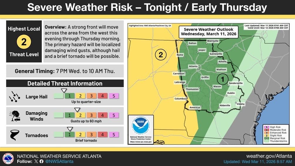
A strong cold front is expected to push a line of showers and thunderstorms through North and Central Georgia Wednesday evening, with the worst conditions possible between 7 p.m. Wednesday and 10 a.m. Thursday, according to the Woodstock Fire Department.
The National Weather Service Atlanta has placed portions of the region under a Slight Risk, Level 2 of 5, for severe storms, with that risk zone extending further east than initially forecast. The primary threats include damaging wind gusts up to 60 mph, quarter-size hail, and the possibility of a brief tornado embedded within the storm line.
The Woodstock Fire Department is urging Cherokee County residents not to let the overnight timing of the storms catch them off guard. The department specifically advised residents to keep their phones charged and have a flashlight within reach in case warnings are issued during the late-night or early-morning hours when many people will be asleep.
While the most significant tornado risk remains concentrated in western Georgia, the storm system's eastward track means Woodstock and Cherokee County could still experience damaging winds and hail as the line moves through. The Storm Prediction Center's decision to nudge the Slight Risk zone eastward reflects the system's potential to remain organized longer than earlier models suggested.
Residents can monitor conditions through the National Weather Service Atlanta at weather.gov/Atlanta or by following @NWSAtlanta on social media for real-time updates as the front approaches.
Share
Related

Cherokee High Senior Ian Zeller Lands $10,000 National Merit Scholarship from Emerson Electric
The Class of 2026 standout, bound for aerospace engineering at the University of Alabama, is among the top 1% of U.S. high school seniors recognized by the prestigious program
Woodstock Community News Staff|

A Third-Grader's Letter Put This Cherokee County Bus Driver on the Braves' Radar
Etowah Zone driver Mike Harper received a gift package from the Braves and Blue Bird Corporation after student Landon Kaufman praised him for two and a half years of kindness and consistency
Woodstock Community News Staff|
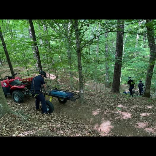
Woodstock Firefighters Train for Trail Rescues at Old Rope Mill Park
B-Shift crews practiced victim location, trail access, and extraction techniques on the park's trail system
Woodstock Community News Staff|
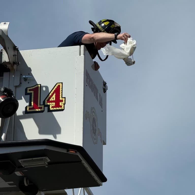
Woodstock Firefighters Raise the Stakes on a Classic Egg Drop Challenge
B shift crews used Truck 14's aerial bucket to help students test their engineering designs from high above the ground
Woodstock Community News Staff|